

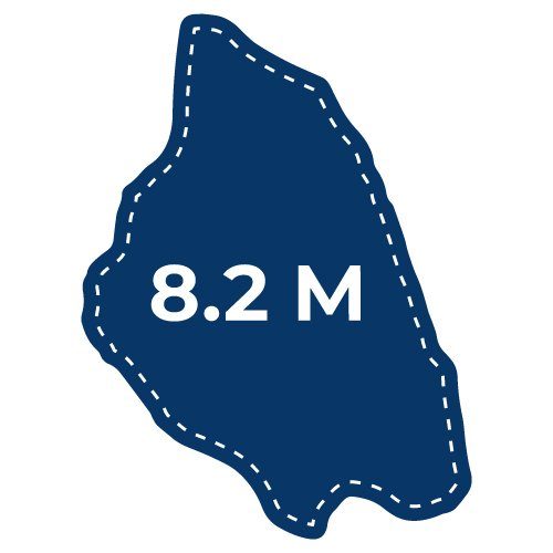
Biking, running or walking the 8.2 miles around Mackinac Island is a popular activity for visitors. It’s easy to understand why when you see the vastness of Lake Huron, listen to the waves crash against the rocks, and have one of the world’s longest suspension bridges, the Mackinac Bridge, as a backdrop.
There are many historical and natural sights to see along State Highway M-185, the car-free road that circles the outer rim of Mackinac Island. Here’s what you can expect when you make your way around Mackinac Island:
GENERAL INFORMATION ON GOING AROUND MACKINAC ISLAND
Don’t worry about vehicles. You’ll be accompanied by horses and bicycles instead! Highway M-185, also known as Lake Shore Boulevard, is the only highway in the nation where vehicles are prohibited (except for emergency vehicles, of course).
If you decide to make your way around the coast of Mackinac Island, walking will take approximately 2.5-4 hours without stopping. You can also bring your own bicycle or rent one from one of the many bicycle shops located on Mackinac Island. It will take you approximately 1 hour to bike without stopping.
However, Mackinac Island is best enjoyed when you’re able to slow down and take it all in. Be sure to add some buffer time for stops along the way. You also can go on a bicycle tour of Mackinac Island that combines a rental with a guided ride that covers the entire perimeter of the island.

PASSING THROUGH DOWNTOWN MACKINAC ISLAND
As you begin your trek, imagine downtown Mackinac Island 100 years ago. You would have heard the clip-clop of horses, cannon fire from Fort Mackinac, and the bustle of people both walking and on bicycles as they make their way from one place to another. That’s exactly what you’ll hear when you visit Mackinac Island today!
Enjoy the views as you pass the quaint shops, historic places to stay and beautiful homes that make up Mackinac Island.
“Mile Marker 0” is across from Marquette Park and the State Park Visitor’s Center. Look for these mile markers along your journey around Mackinac Island.
MACKINAC ISLAND’S NATIVE AMERICAN CULTURAL HISTORY TRAIL
There are 6 informative signs along M-185 on Mackinac Island’s Native American Cultural History Trail. Here you can stop and learn more about the impact and history of Native Americans on Mackinac Island and the Great Lakes. Most of these signs have seating options nearby if you need a moment to rest.
- Mackinac Island Field Trip: 5 Great Cultural Lessons
- A bit of background on the Biddles, of Mackinac Island

MACKINAC ISLAND’S ARCH ROCK
Ascend 207 steps from the road to see Mackinac Island’s stunning Arch Rock at eye level. You will see a pull-off area with bicycle racks and benches on the east side of M-185. The climb is steep but the views are worth it!
There are 24-hour restrooms located at the top of Arch Rock, water fountains, and picnic tables. As you get back on the highway, don’t forget to look back and see just how massive Arch Rock is from below.

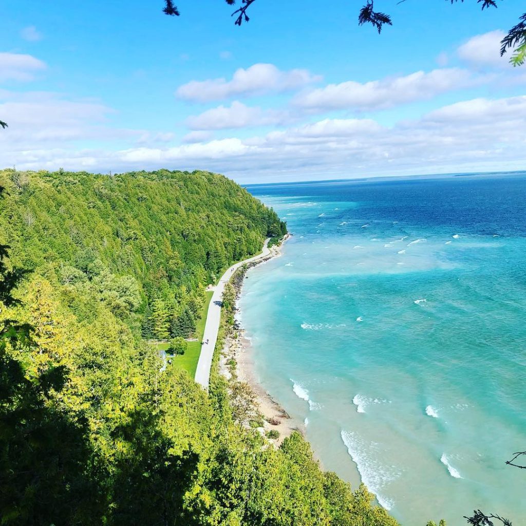
LAKE HURON ALONG M-185 ON MACKINAC ISLAND
With the ever-changing wind, water, and weather, no day is ever the same on Mackinac Island. Enjoy the blues and teals of the second largest Great Lake. Listen to the sounds of the gulls and water splashing against the rocks. Pass kayakers, sailboats, ferries and paddle boarders. And if you want, dip your toes in the water and enjoy the stillness of Mackinac Island.
BRITISH LANDING ALONG M-185 ON MACKINAC ISLAND
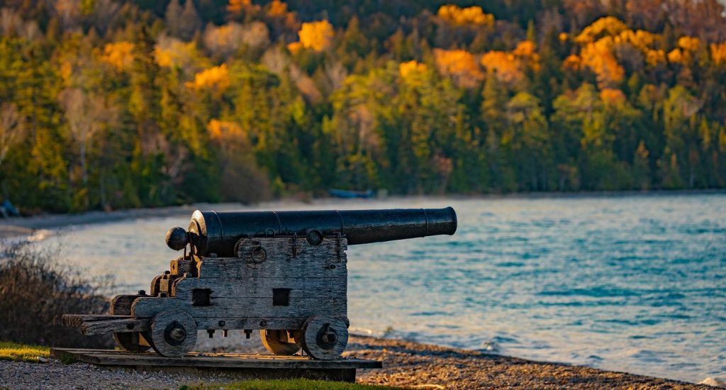
Don’t turn around now! You’re about halfway around the 8.2 miles when you get to British Landing. This historic location is where the British and Native American allies landed in 1812, hence the name British Landing. They took over the highest point on Mackinac Island (current-day Fort Holmes) and eventually Fort Mackinac. There are historical markers, benches and a cannon at British Landing.
- Mackinac Island Field Trip: 5 places for interactive history lessons
- Things to do on Mackinac Island for history buffs
MACKINAC BRIDGE VIEWS AT BRITISH LANDING
If you are going counter-clockwise around Mackinac Island, British Landing is where you’ll start to see the world’s 5th largest suspension bridge! The 5-mile long Mackinac Bridge connects Michigan’s lower and upper peninsulas. Learn more about this iconic structure and enjoy its beauty for the rest of your ride around Mackinac Island.
This is also the point where you’ll see people enjoying drive-it-yourself Mackinac Island horse carriages from Jack’s Livery.
- Ever hear of this Mackinac Bridge plan?
- 9 ‘absolutely stunning’ places for a picnic on Mackinac Island
BRITISH LANDING NATURE CENTER ON MACKINAC ISLAND
Experience the wildlife, plants and geology on Mackinac Island in this interactive nature center. Inside you will find a large cedar tree trunk, native animals on display, and more information about the natural history of Mackinac Island. There are 24-hour accessible restrooms, a water fountain, tables, benches and a bike repair station if needed.
CANNONBALL OASIS ALONG M-185 ON MACKINAC ISLAND
Grab some famous fried pickles, hotdogs, ice cream and more at the Cannonball Oasis. Located at British Landing, this is a great half-way point to take a break, have a snack, enjoy the water and skip some rocks!
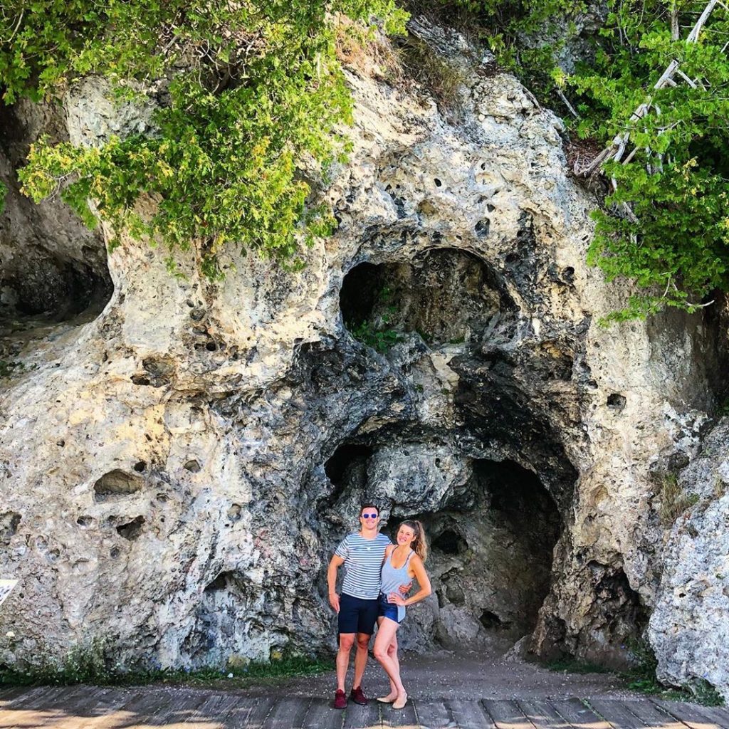
DEVIL’S KITCHEN ALONG M-185 ON MACKINAC ISLAND
Cross another Mackinac Island formation off your bucket list. This small cave is along the western shores of Mackinac Island.
Why Devil’s Kitchen? Legend says it’s a place where evil spirits capture and eat people who get too close. The blackened limestone is residue from fires built by the evil spirits. So perhaps you don’t want to stop and visit?

PONTIAC TRAIL ALONG M-185 ON MACKINAC ISLAND
Discover this hidden trail that runs along Mackinac Island’s West Bluff. Up here you have a bird’s eye view of the Mackinac Bridge and, if you’re in luck, a freighter passing through the Straits of Mackinac. Pontiac Trail is accessible by stairs on the west side of M-185.
MACKINAC ISLAND PUBLIC SCHOOL AND BOARDWALK
As you make your way back to town, you’ll pass by the Mackinac Island Public School, home of the Lakers. There are about 80 students enrolled year-round. The boardwalk in front of the school extends to Hotel Iroquois and is a great place to enjoy a sunset at the end of the day!
View this post on Instagram
