

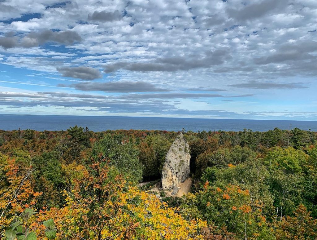
Mackinac Falls must have been quite a sight, just like today’s Arch Rock. Mackinac Island’s most photographed natural wonder stands some 140 feet above Lake Huron and forms a perfect picture frame with its magnificent limestone arch. But about a mile east of Arch Rock, there’s an even more incredible rock formation.
Unfortunately, Mackinac Falls is now sitting under 110 feet of water.

The History of Mackinac Falls
Several thousand years ago, when lake levels were much lower, water from an early form of Lake Michigan flowed eastward past what is now Mackinac Island and over a cliff. At that time, the Straits of Mackinac was a river, and the water plummeted 100 feet over Mackinac Falls as it made its way to an early form of Lake Huron.
By comparison, Tahquamenon Falls in Michigan’s Upper Peninsula is only 48 feet high.
The waterfall surely was an attraction for people of the time the way Arch Rock is for Mackinac Island visitors of today. In fact, researchers have discovered an underwater limestone cave by Mackinac Falls that probably was used as shelter by people way back then!
Mackinac Island’s Surviving Rock Formations
Although you can’t visit Mackinac Falls today (unless you’re a scuba diver!), it’s another example of the incredible geological features in the area. In addition to being known for world-famous fudge and horse-drawn carriages, Mackinac Island is an amazing outdoor museum of natural history.
Arch Rock, Sugar Loaf and Devil’s Kitchen are some of the more popular limestone attractions, but they’re far from the only ones. Have you heard of Skull Cave? How about Crack-in-the-Island? Or Friendship’s Altar?
“It pleases chiefly by its novelty, so wholly unlike anything to be found in other parts of the world, and on first approaching it, gives the idea of a work of art.” –geographer Henry Schoolcraft, upon encountering Mackinac Island’s Sugar Loaf more than 200 years ago
There’s a lot to explore and discover in the wilderness of Mackinac Island State Park. It makes up more than 80% of Mackinac Island and contains more than 70 miles of trails.
Fortunately, the majestic rock formations on Mackinac Island have lasted for thousands of years, but that doesn’t mean they’ll be around forever. After all, Mackinac Falls was around for thousands of years, too, before it was submerged by rising lake levels.
Some Mackinac Island Rock Formations Have Disappeared
Rockfalls at Pictured Rocks National Lakeshore in Michigan’s Upper Peninsula happen regularly, changing the face of the natural wonders there. And even some Mackinac Island landmarks that existed in the 1900s are no longer here.
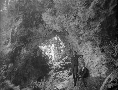
For example, Fairy Arch was located not far from Arch Rock near Mission Point Resort. The six-foot span had survived for 3,000 years before it was removed. And you might notice a Scott’s Cave Road on a map of Mackinac Island, but you no longer can find Scott’s Cave. The limestone feature named after a former post commandant at Fort Mackinac was at the north end of Mackinac Island. When lake levels were higher than they are now, waves hollowed out the rock into a cave about 15 feet long, eight to 10 feet wide and nine feet high. Like Fairy Arch, Scott’s Cave did not survive into the 21st century.
The good news is that the surviving limestone formations on Mackinac Island all appear to be stable and in good shape and hopefully will be here for generations to come!
RELATED MACKINAC ISLAND BLOGS:
